On a January night in 2024, dozens of Hingham residents logged onto a Zoom call to find out that a wooded lot near the corner of French and Hobart streets, the kind of parcel most people drive past without a second look, was being discussed as the site of a possible 120-unit building. The land had been a contractor's yard for years, an industrial use that never quite matched its residential zoning. Now it was at the center of a debate about where Massachusetts' new multifamily housing law would actually land in town.
That meeting, and the one that followed two weeks later, ended up deciding something more useful to today's buyers than most people realize. It settled where Hingham's compliance with the MBTA Communities Act would live on a map, and just as importantly, where it wouldn't.
What the law required, and what it didn't
The state's MBTA Communities Act asked every city and town served by the T, including those with ferry access, to zone at least one district where multifamily housing is allowed by right, no special permit needed. For Hingham, classified as a commuter rail community, the number came out to roughly 50 acres of land with the capacity for 1,490 units at a minimum density of 15 units per acre. The town confirmed it had met that requirement, and the Executive Office of Housing and Livable Communities issued its Determination of Compliance on March 19, 2025.
What the law never dictated was where inside town that district had to go. Towns got to draw their own lines, as long as the math worked and the parcels sat within a reasonable distance of transit. That discretion is the part worth understanding if you're comparing Hingham to any other South Shore town on your list, because two towns can both be "compliant" and still have made completely different choices about which streets absorbed the change.
Where Hingham pointed the district
Hingham pointed almost all of it at land that was already carrying multifamily housing, just not by right.
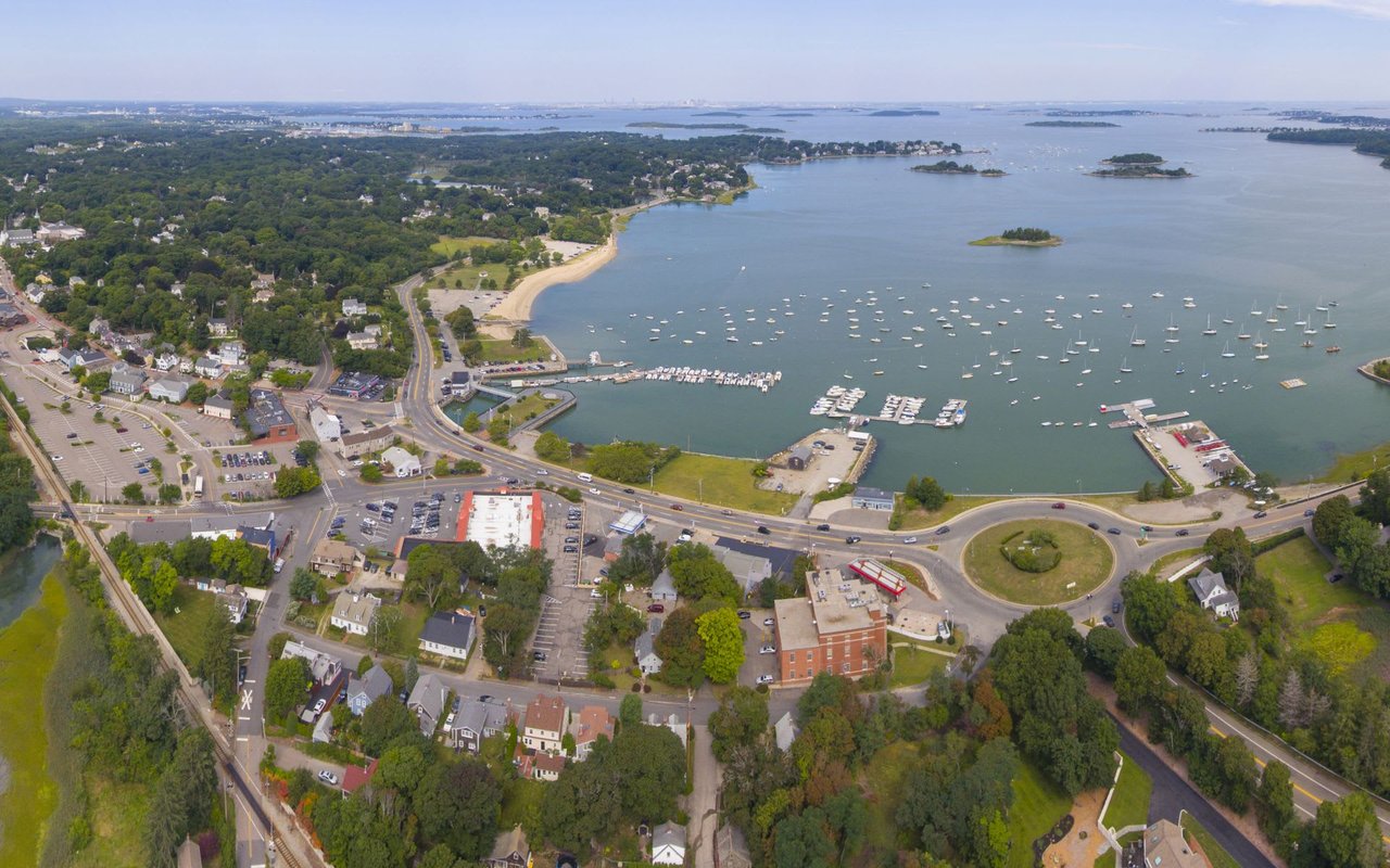
The bulk of the compliant district sits inside and around the Hingham Shipyard, the same ferry terminal area that's home to condo buildings built under special permits or 40B comprehensive permits over the past two decades. The parcels named in the town's own zoning article include the Hewitts Landing Condominium at 319 Lincoln Street, 111 Fitzroy Drive, 152 Shipyard Drive, and The Cove at 350 Beal Street. None of these properties were empty land waiting for a decision. They were already dense, already zoned for exactly this kind of housing in practice, just not technically by right until the town voted.
The one genuine exception was French Street. That parcel sat outside the Shipyard cluster, roughly between the West Hingham and East Weymouth commuter rail stations, and it was the only piece of the proposed district that touched land residents had never associated with multifamily housing. It's also the only piece that generated real, sustained pushback at two separate Planning Board meetings.
The trade that happened in that room
What's easy to miss, reading about this after the fact, is that the board didn't just push the French Street objections aside. Members went looking for a way to shrink it. One board member pointed out that the town's own compliance model suggested something closer to 60 units would satisfy the requirement at that site, well under the 120-unit figure originally floated. The eventual approach was to upzone additional Shipyard parcels enough to absorb more of the required unit count, which allowed the board to trim French Street's share in the final article that went to Town Meeting on April 24, 2024.
That's the mechanism worth sitting with. When a town has room to choose, the path of least resistance runs through land that's already doing the job, not through streets full of single-family homes with owners who show up to Zoom calls. Hingham had that room because the Shipyard corridor already existed as a dense, transit-adjacent pocket. Not every town does.
Here's roughly how the map broke down:
| Area | Status before the law | Part of the compliant district? |
|---|---|---|
| Hewitts Landing, 319 Lincoln Street | Existing condos, permitted individually | Yes |
| The Cove, 350 Beal Street | Existing condos, permitted individually | Yes |
| 111 Fitzroy Drive / 152 Shipyard Drive | Existing multifamily near ferry terminal | Yes |
| French Street parcel | Nonconforming contractor's yard in a residential zone | Yes, at reduced scale |
| Village center, Hingham Harbor, Crow Point, Liberty Pole, South Hingham | Single-family residential | No |
That last row is the one buyers cross-shopping Hingham should actually care about. The classic neighborhoods that show up in most searches, the harbor-facing streets, the village center near Derby Street, the areas locals refer to as Crow Point and Liberty Pole, sit entirely outside the by-right multifamily overlay. Nothing in the town's approved zoning changes what can be built on those lots.
What compliance unlocks, and what it doesn't guarantee
It's worth being precise about what "compliant" actually means in practice, because the law itself is careful on this point. Hingham and other towns aren't required to make sure 1,490 units get built. They're required to make sure the zoning allows a developer to build up to that capacity without needing a special permit. Whether the owners of Hewitts Landing, The Cove, or the French Street parcel ever pursue additional construction is a separate business decision that hasn't been made public.
Compliance did come with one tangible benefit for the town: it qualified Hingham for the state's MBTA Communities Catalyst Fund, a grant program tied to compliance status. That's a town-level financial detail, not a signal that construction is imminent on any specific parcel.
Why this matters more than the median
If you're comparing Hingham to Scituate, Braintree, or Quincy, all of which also appear on the state's list of communities that have passed compliant zoning, resist the urge to assume they solved the puzzle the same way. Each town drew its own map based on its own inventory of already-dense land, its own transit geography, and its own political appetite for friction. A buyer who hears "MBTA Communities zoning" and pictures a uniform wave of apartment construction rolling across every South Shore town is working from a headline, not from any specific town's actual district.
The more useful question, wherever you're looking, is the one Hingham's Planning Board spent two meetings answering out loud: where exactly does the compliant district sit, and does it touch the block you're buying on.
A few direct questions
Does the new zoning law affect my street if I'm looking in Crow Point, Liberty Pole, or South Hingham? Based on the district Hingham submitted and the state approved, no. Those areas are not part of the by-right multifamily overlay.
Is Hingham's compliance still under review, or could the map change? EOHLC's determination is dated March 19, 2025, and stands as completed. Any future expansion of the district would require its own Town Meeting vote and its own review process, not an automatic change to today's boundaries.
Does compliant zoning mean construction is happening now? Not necessarily. The law requires the potential for by-right development, not a build-out mandate. Whether property owners inside the district choose to develop further is up to them.
Do neighboring towns have the same setup? No. Every MBTA community drew its own district. Scituate, Braintree, and Quincy each made their own choices about where to place theirs, so nothing about Hingham's map can be assumed for a town one exit down Route 3.
If you're weighing Hingham against another South Shore town and want to understand exactly where a compliant district sits relative to a specific street you're considering, that's a conversation worth having before you write an offer, not after. Pamela Bates has spent years tracking how these local decisions actually play out on the ground in Hingham and the surrounding towns. Let's connect.